On the night of June 23, recordings posted on Yevgeniy Prigozhin's Telegram channel set in motion the biggest threat to Putin's authority since he took power 24 years ago. The mutiny involved four to eight thousand troops, tanks, armored vehicles, anti-aircraft weaponry, and civilian trucks.
During the revolt, there were mixed reports about troop locations, losses of vehicles and aircraft, Russian response, and what actually was happening on the ground. Most maps made in the moment by news outlets were extremely vague in their reporting, and served more to give readers an idea of where Rostov was in relation to Moscow than to provide meaningful information or verify anything coming from social media.
My map is not an authoritative collection of every piece of media produced during those 24 hours, nor documentation of all equipment seen or lost during the revolt. Instead, I wanted to tell a complete story of June 24 with images and videos, while tying them back to a location on Earth. It is best read from bottom to top.
List of geolocated points:
2. Man plays accordion in Rostov. https://twitter.com/ThomasVLinge/status/1672535069074890753
12. Wagner column passing through Buturlinovka. https://twitter.com/aldin_aba/status/1672545565572231173 (archived)
13. A pair of Wagner Pantsir-S1 SAM systems move in Buturlinovka. https://twitter.com/Osinttechnical/ (archived)
15. SAM shot at helicopter flying overhead. https://twitter.com/WarMonitors/status/1672555920767741956?s=20 (archived)
16. Burning Russian helicopter near Pavlovsk. https://twitter.com/Osinttechnical/status/1672479628491882498 (archived)
19. People in Lipetsk dig out road. https://twitter.com/bayraktar_1love/status/1672609041938251777 (archived)
20. Truck blockade on Moscow highway. https://twitter.com/wartranslated/status/1672588006476185602 (archived)
21. Prigozhin voice recording turns troops around. https://t.me/concordgroup_official/1303 (archived)
Geolocation Example: Point Num. 11
While I was unable to collect and geolocate every relevant media posted online on June 24, I selected posts that revealed a significant development, like an aircraft loss or the involvement of Chechen troops. Some were easier to geolocate than others, and many had not previously been geolocated precisely by anyone online to my knowledge.
For demonstration, I will explain how I geolocated point 11, showing a strike on trucks parked on a road near Bugaevka, 49.65281, 39.76028.
Бугаевка, под Кантемировской, Шойгу против Пригожина, 24 июня
I first saw the video above, posted on Twitter by Igor Girkin, pro-war Russian blogger and veteran (who was recently arrested in Moscow). The text of the post translates to "Bugaevka, near Kantemirovsky, Shoigu against Prigozhin, 24 July." This description immediately narrows down the geolocation, keeping in mind that it could be incorrect or misleading.
Immediately, I noticed that the road we were driving on was two lanes and curving slightly to the left, with minimal shoulder. Additionally, if the dashcam timestamp is to be trusted, it is mid-morning and the sun should be casting shadows from the easterly direction. Therefore, based on the shadow cast by the trucks driving on the other side of the road, I believed that we were driving in a southward direction.
Кадры уничтоженной машины на трассе рядом с посёлком Бугаевка в Воронежской области.
I also found this video posted on telegram which appears to show the aftermath of the attack, based on the road looking similar and the description, locating the video to "near the Bugaevka settlement in Voronezh oblast." This much longer video shows in detail the destroyed truck, but also the topography of the surrounding area, including the hills in the background.
Unfortunately there is no google street view on the streets around Bugaevka, which would have made this process much easier. Instead, using the satellite basemap on google maps, I looked around Bugaevka for a two-lane road going south, turning west slightly. I found a few of these kinks in the road, but I needed some specific signal to confidently say exactly where the event occurred. This is where satellite imagery came in to close the case.


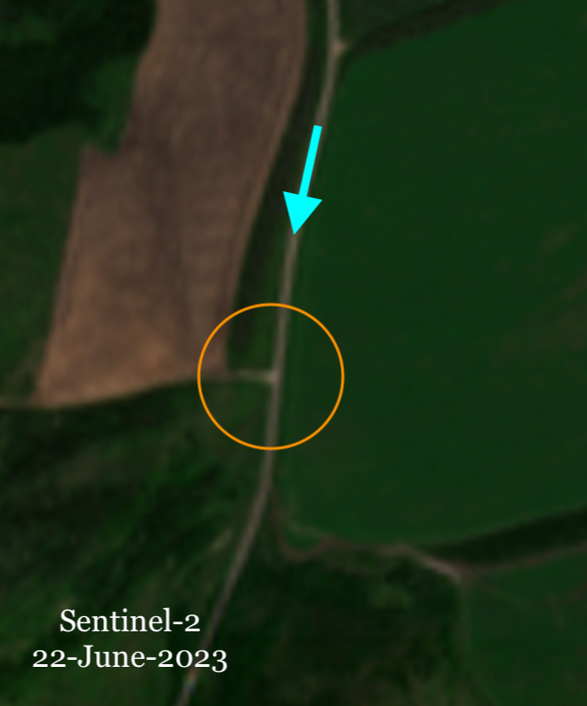
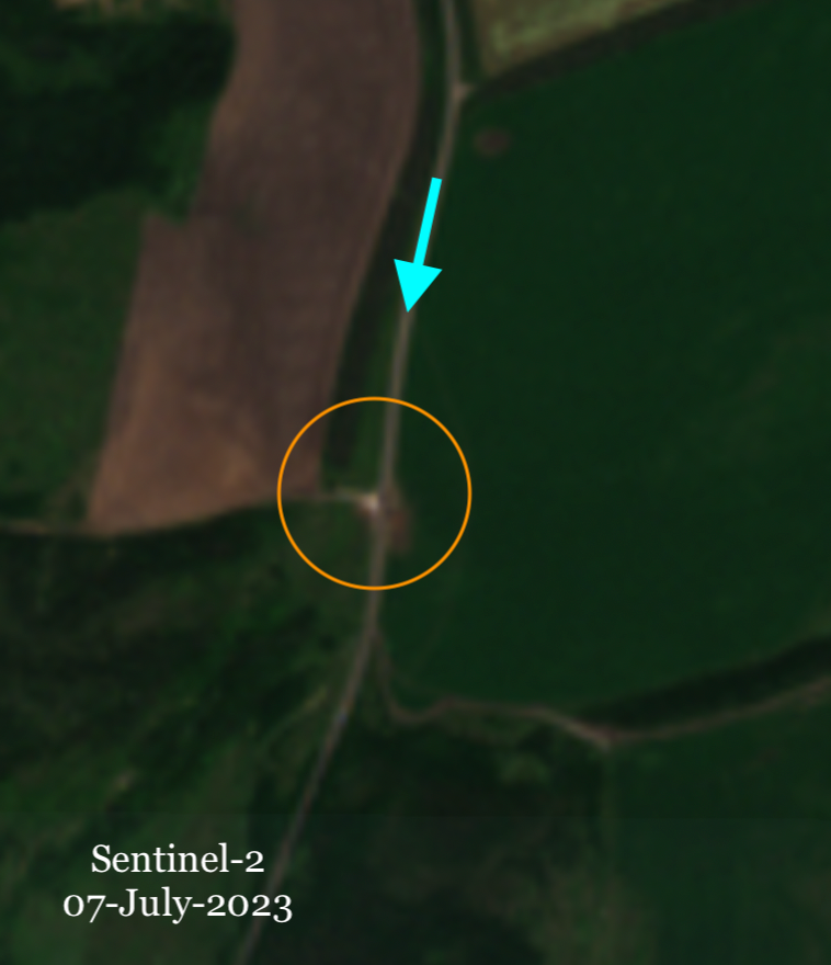
Looking at my locations of interest with Sentinel-2 imagery available for free on EO Browser, I could see evidence of an explosion and burn marks on and near the road. The blue arrow is the direction from which I believed both videos were filmed.
While the evidence so far would have been sufficient for geolocation, imagery obtained from Planet Labs on June 24, the day of the explosion, really seals the deal. Coincidentally, the Planet satellite made its daily pass at 10:27 AM local time, just 14 minutes before our dashcam footage shows the missile strike. Highlighted in pink in the image, you can see a long line of white 18-wheelers lined up along the road. These trucks are also seen in the videos, moving slowly or parked along the roadway.
Parked white trucks seen from satellite, just minutes before the shelling.
All of this evidence leads to a strong geolocation of a shelling location that had previously just been described in a vague way. Importantly, I was able to confidently assign coordinates to the event and put it on my map. All other points included in the map were geolocated using similar strategies and tools, with saved workflows. Thanks to Tessa and Daniel for help and second opinions during the process.
One important aspect of this project that was not included was any analysis of equipment or vehicles under control by Wagner troops. For this geolocation, for example, it is not entirely clear whether the white trucks parked and targeted were Wagner forces or private delivery trucks, who ordered and carried out the strike, or even what projectile or missile was used in the strike. Despite leaving these questions unanswered, I think geolocating and spatially summarizing my list of events of June 24 is still a valuable product, and gives the reader a fact-based understanding of the developments and social media space during the revolt.